Scenic Tennessee

Tennessee Vistas Project

Creating a Tennessee Scenic Viewshed Register

Launched in 2022, Tennessee Vistas is a multi-year, community-based effort to identify, map and encourage / facilitate the protection of Tennessee’s most outstanding scenic views, whether of natural or manmade elements, for use in strategic planning, conservation, promotion and education. The heart of Tennessee Vistas will be an interactive online map (ArcGIS hub) hosted by the state’s GIS services office, populated with photos, narratives, location data and other information, and freely available to all users, from community leaders wishing to incorporate scenic resources in comprehensive plans, to families seeking a unique Tennessee vacation.

Cabin in Seymour. Larry Anderson, St. Louis, MissouriScenic Tennessee photo contest collections.

Project objectives

Tennessee Vistas seeks to:

  • Ensure the integrity and future of Tennessee’s most outstanding scenic views, especially those not previously recognized or protected.
  • Increase awareness among all Tennesseans of the enormous value—aesthetic and emotional as well as economic and environmental—of Tennessee’s scenic views.
  • Engage citizens, organizations and local governments in identifying, ranking and documenting the views they consider essential to the character, history, economy and quality of life in their community or region.
  • Provide a readily accessible online resource for use in comprehensive planning and land-use decision-making, as well as in tourism, marketing, economic development, environmental protection and conservation education.
  • As needed, provide guidance and resources in land preservation strategies, visual resource management and visual impact mitigation.
Scenic vistas have inspired humans since time immemorial, including generations of landscape painters and photographers. Cumberland Mountain Hunters, by Samuel M. Lee, 1830-1840, oil on canvas, Smithsonian American Art Museum, Museum purchase, 1976.139.

What is a viewshed?

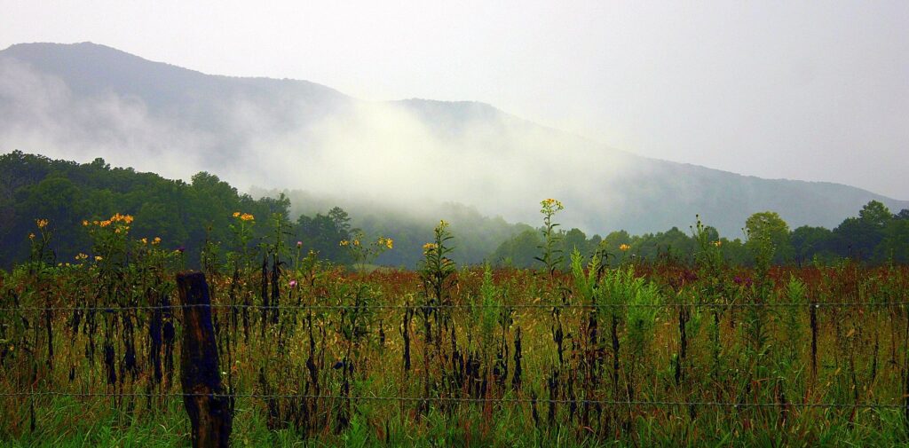
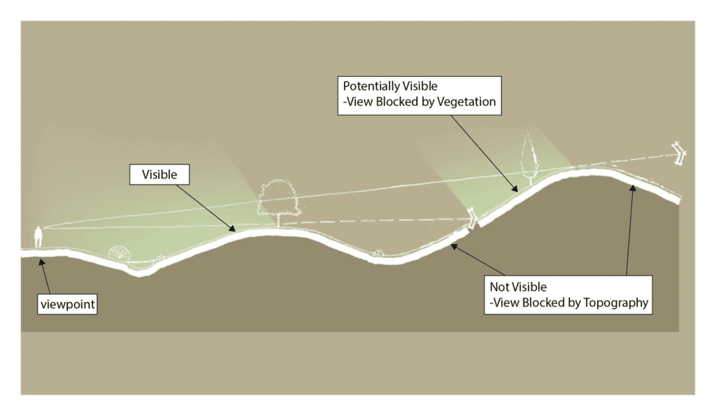
Simply put, a viewshed is what you can see when you look out from a particular point, typically though not necessarily at a considerable distance. Here’s a definition and schematic from the Virginia Scenic Viewshed Assessment Project: Literature Review and Assessment Methodology (you can download it here):

The term “viewshed” is derived from the concept of a watershed. A watershed is an area in which all of the rainfall that falls will flow past a specific point. A viewshed is “the 360‐degree area” that is seen from a specific point, called a viewpoint. Portions of the area may not be visible from the viewpoint because the view is blocked by vegetation, topography, or other objects.

Patrick Miller et al, Virginia Scenic Viewshed Assessment Project: Literature Review and Assessment Methodology, 2019

Schematic section depicting seen and potentially seen areas from a viewpoint. From Virginia Scenic Viewshed Assessment Project: Literature Review and Assessment Methodology, by Patrick A. Miller, Jisoo Sim, Leighton Powell and Lynn Crump, 2019. Used with permission.

The authors go on to note that when we talk about a viewshed, we’re usually talking about a specific slice of that 360-degree pie. Strictly speaking, this is a “defined viewshed”—what we see when we look in a given direction. For our purposes, therefore, whenever we use the term viewshed, we are talking about a defined viewshed.

What is a viewshed register?

The term “viewshed register” is fairly new, having been coined by the Virginia Scenic Viewshed Assessment Project in 2019, but in general it refers to the “cream of the crop” of a given region’s scenic views as determined by visual-assessment tools and public review. While the information in a viewshed register may be presented in various formats, including spreadsheets and written reports, the most common means of access to the Tennessee Scenic Viewshed Register will be online, by clicking on any of the data points on the cloud-based ArcGIS map developed and hosted by the state’s STS-GIS office.

Located just 10 miles south of downtown Nashville, Radnor Lake State Natural Area typically attracts half a million visitors a year, 4 times that during the pandemic. But at one point in the 1960s, a prospective developer actually proposed draining much of the lake—beloved of birders, botanists and hikers—to make room for house lots. After much anxiety and last-minute fundraising, the state acquired the land on August 16, 1973. Credit: tennesseetrails.org.

Why does Tennessee need a viewshed register?

Tennessee has grown by more than a million residents since 2000 and is projected to add a million more by 2040. With such growth comes pressure: pressure to subdivide family farms, build utility lines along scenic ridges, turn beloved open space into schools and shopping malls. Without advocacy, private endowments or proactive planning, it’s hit or miss whether such resources will be around 20 years from now, let alone into the next century.

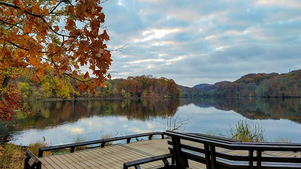
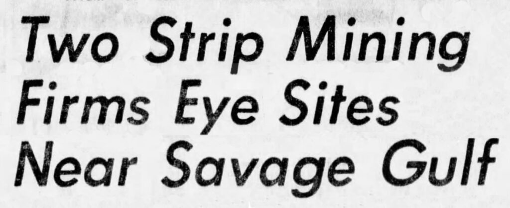
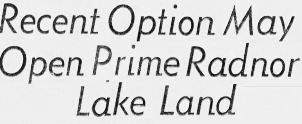
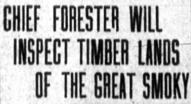
Consider Nashville’s Radnor Lake, Savage Gulf, Overton Park in Memphis, even Ryman Auditorium and the Great Smoky Mountains themselves. Most of us take these scenic beauties for granted today, but there was a time when they were at serious risk from development, urban sprawl, road building, mining and other encroachments.

1973
1971
1911

All of these places were ultimately preserved, of course, thanks to the collective rallying of citizens, organizations, businesses, governments and lawmakers. But the process was often fraught with political tensions, fundraising deadlines and legal complications. Meanwhile, countless other views were lost for lack of advocates to protect them, or even to identify them as worthy of protection.

This is why Tennessee needs the Tennessee Vistas project: to get a jump on the inevitable demands of growth by identifying scenic views judged by local communities to have such exceptional natural or cultural qualities that losing them would be an unacceptable loss—to the surrounding community, to regional economies, to historic integrity, to environmental quality, to recreational opportunities or to spiritual and emotional well-being—and then making this information freely available to communities to act on if and when they choose.

This last point is important: Tennessee Vistas will not mandate any action, limit any freedoms or impose any protected status. The actions it may inspire—for instance, to create conservation easements, form new land trusts, expand comprehensive plans or apply thoughtful mitigation techniques when development is necessary or inevitable—are entirely up to elected officials, public agencies, citizen advocates and private interests. The Tennessee Scenic Viewshed Register will be there if they need it.

Cades Cove. Nancy Greene, Luttrell, TennesseeScenic Tennessee photo contest collections.


How will Tennessee Vistas work?

Tennessee Vistas will proceed one region at a time, roughly following the nine Tennessee Development Districts, starting in summer 2022 with a pilot inventory in four counties in the Upper Cumberlands: White, Putnam, Jackson and Overton.

In each region, we’ll use existing communications channels to publicize the inventory, explain the nominations process and invite submissions. These will come from official and organizational sources (local governments, state agencies, nonprofit organizations and so on), as well as members of the general public.

Submitting a nomination will be as easy as photographing a view with a smartphone and using the location data in the phone’s tracking app to complete an online nomination form. Popular, already protected viewsheds (for instance, within a state or national park) may certainly be nominated, as well as more hidden gems, such as a view down a quiet country road or across a pasture dotted with bales of hay. The only “rule” is that the viewpoint (the point from which the viewer takes the photograph) must be publicly accessible.

Once the submissions are in (and duplicates and non-compliant submissions are taken out), we’ll organize one or more community gatherings to review the nominations, rank them using the forms and criteria developed by the Virginia project (see below), and determine the views that will become part of the Tennessee Scenic Viewshed Register.

Ranking the viewsheds

The Tennessee Vistas project has (gratefully) appropriated the ranking methodology developed by the Virginia Scenic Viewshed Assessment Project. In this system, participants rank viewsheds in a total of eleven criteria, resulting in numeric scores in two assessment categories:

  • Viewshed scenic quality (for instance, viewshed size, visual complexity, natural condition, presence or absence of “distracting content” such as power lines, etc.)
  • Public concern or sensitivity (for instance, demonstrated public awareness, number of viewers, historical or cultural features, etc.)

The assessment category scores are then placed on a third X/Y axis form to arrive at one of three scenic designations:

  • I = INCLUDE (designate as a scenic viewshed)
  • N = NOT INCLUDE (do not designate as a scenic viewshed)
  • SC = SPECIAL CONSIDERATION (designate as a scenic viewshed if other conditions merit)

Here are the ranking tables developed by the Virginia Scenic Viewshed Assessment Project:

Ranking Form #1: Viewshed Scenic Quality

Ranking Form #2: Public Concern or Sensitivity

Ranking Form #3: Scenic Viewshed Designation

Putting Tennessee Vistas online

Once the slate of new inductees has been finalized, project administrators will enter their accompanying data—photos, GIS coordinates, narrative descriptions, driving and/or hiking directions and so on—onto a 3-D LiDAR-elevation map that is the heart of the ArcGIS web platform created for this project under contract with the GIS services office of the state’s Strategic Technology Solutions (formerly the Office for Information Resources—basically the IT division of state government).

Each viewshed location will appear as a dot on the statewide map, but clicking on that dot will open up a wealth of information, which may be augmented with videos, archival photos, links to other sites and simulations (images showing what a view would look like if, for instance, it included a four-lane highway or a new housing subdivision). The ability to predict the visual impacts of potential development—or potential mitigation—will be one of the most interesting features of the Tennessee Vistas project.

Support Our Work

We need your help to keep Tennessee scenic.

Give Now